
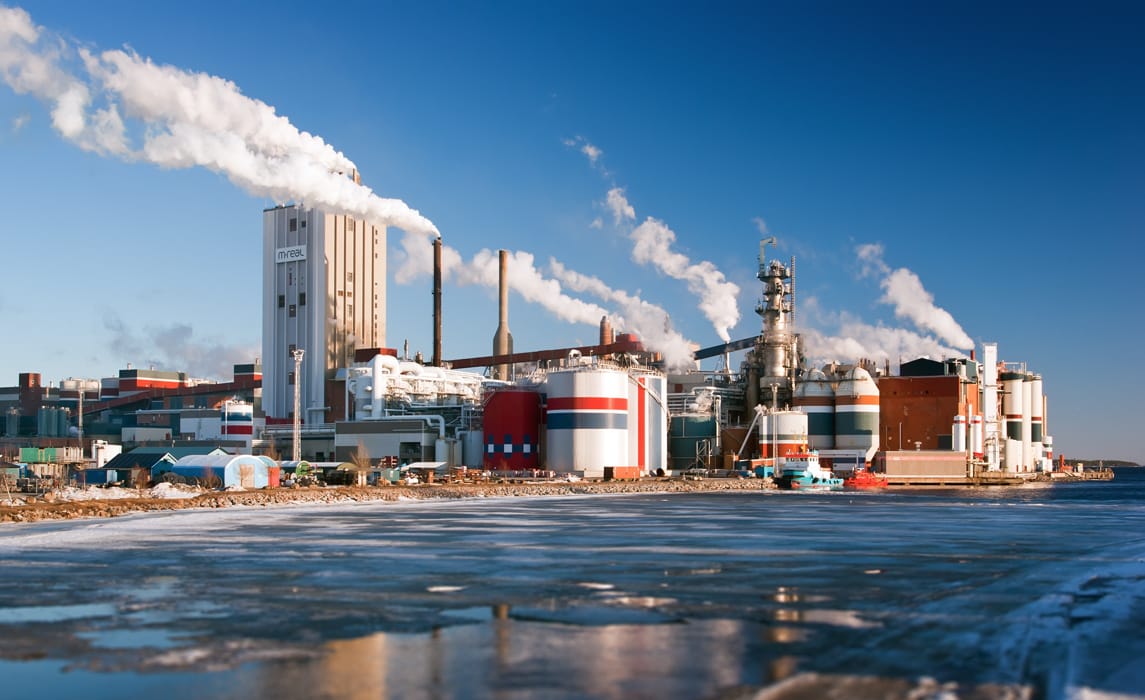
An 1,800-Hectare Industrial Estate in Medan, North Sumatra
SIIPE is an industrial estate on the North Sumatra coast near Medan, 4.7 km from Belawan Port and connected to the Trans-Sumatra toll road. Of the 3,000-hectare current phase, 1,800 hectares are allocated to industry, with separate zoning for heavy manufacturing, light manufacturing, and warehousing. This page carries the data prospective tenants ask for first: distances, masterplan, zoning, and land status.
- Belawan Port
- 4.7 km10 MIN
- Kuala Namu Int. Air Port
- 38.8 km74 MIN
- Industrial estate
- 1,800 HaESTATE
- Deep seaport
- 400 HaPORT
The Industrial Estate at a Glance
Site figures first, then road distance and travel time from SIIPE to the logistics points a site-selection team checks first.
| Item | Figure |
|---|---|
| Total site area | 5,600 ha |
| Current development phase | 3,000 ha |
| Industrial estate | 1,800 ha |
| Deep seaport (planned) | 400 ha |
| Residential township | 800 ha |
| Land already acquired | 840 ha |
| Coordinates | 3°47'24.0"N 98°44'11.2"E |
| Destination to / from | Distance (km) | Time (minutes) |
|---|---|---|
| Belawan Port | 4.7 | 10 |
| Medan Belawan Port | 27.7 | 60 |
| Kuala Namu International Air Port | 38.8 | 74 |
| Sei Mangkei Economic Zone | 148 | 188 |
Belawan Port sits within a 10-minute drive of the estate, placing sea freight, air freight and the Sei Mangkei Economic Zone on a single road corridor.
Location and Accessibility from Medan and Belawan
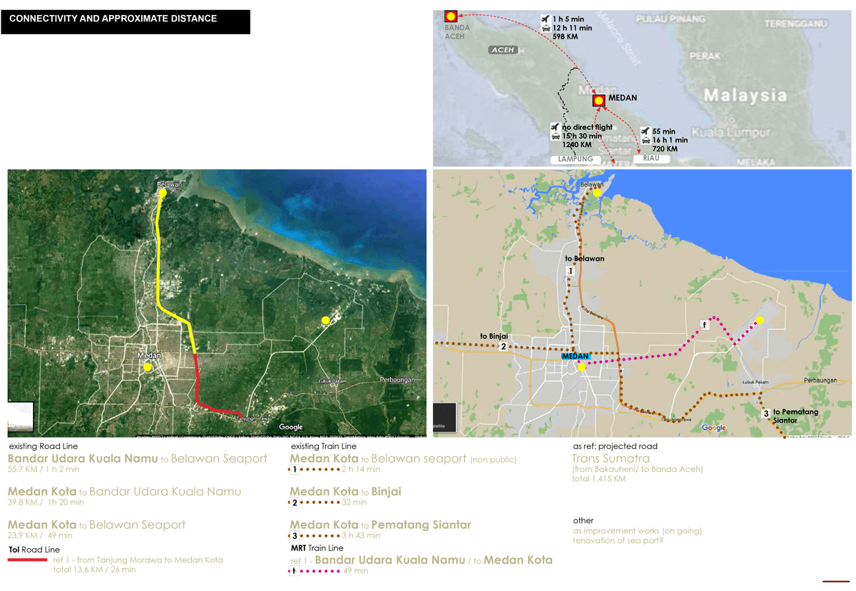
As a Malacca Strait industrial estate, SIIPE sits on the sea lane that carries about 120,000 ships a year by our published estimate, with Belawan Port 4.7 km from the site. The estate connects to sea, air and inland freight through the same corridor. For manufacturers, that proximity determines transport cost, lead time and how much inventory a plant has to hold.
Sea freight through Belawan
Belawan Port is 4.7 km from the estate, a 10-minute road journey, with Medan Belawan Port 27.7 km away.
Air freight and passenger access
Kuala Namu International Airport is 38.8 km away, reachable in 74 minutes by road for time-critical cargo and visiting teams.
Regional industrial linkage
The Sei Mangkei Economic Zone lies 148 km inland, connecting the estate to established processing activity across North Sumatera.
Industrial Estate Masterplan and Zoning
The masterplan divides the site into heavy industry, light industry, warehousing and logistics, a utilities block, commercial areas, and the residential township. This is not cosmetic. Firm zoning keeps industries with heavy effluent loads, noise, and truck traffic out of areas that were never engineered to carry them, which protects both tenants and the land value around them.
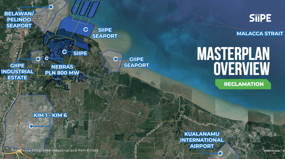
Sizeable land bank in a strategic location with upside potential
The scale of the land bank allows the estate to accommodate both large single-user plants and clustered industrial tenants, while keeping room for phased expansion as demand develops.
Industrial Land in Indonesia: Development Plan by Block
Planned area and the freehold (SHM) land available in each block of the business and land development plan. Block-level title status, schemes and licensing are set out on the industrial land page.
| Block | Planned area | Available |
|---|---|---|
| Commercial block | 384 ha | 25 ha freehold available |
| Utilities block | 198 ha | 68 ha freehold available |
| Clean block | 158 ha | 127 ha available, of which 26 ha freehold |
| Residential | 100 ha | 10 ha freehold available, 10,000 units planned |
SHM refers to Sertifikat Hak Milik (Right of Ownership Certificate). Planned areas are masterplan allocations; availability is confirmed on request.
The Sumalacca Deep Seaport Planned Inside the Estate
The 400-hectare port component is planned as Sumalacca Dry & Liquid Bulk Port, with a basin depth of -8 to -10 m LWS and a 13-nautical-mile shipping channel to the Strait of Malacca. It is planned to handle dry bulk and liquid bulk, which would put palm oil downstream products, bulk chemicals, cement and aggregates on berth infrastructure inside the estate itself. Belawan Port remains 4.7 km away for containerised cargo; for the port next door, see a complete profile of the Port of Belawan.
| Item | Plan |
|---|---|
| Planned port area | 400 ha |
| Basin depth | -8 to -10 m LWS |
| Shipping channel | 13 nautical miles to the Strait of Malacca |
| Cargo types (planned) | Dry bulk and liquid bulk |
| Distance to Belawan Port | 4.7 km |
| Position | Lowland between the Belawan and Deli rivers |
The port is at the planning stage and is not operational. Berth count and throughput have not been published.
Industrial Sectors in North Sumatra We Can Accommodate
From heavy processing to light manufacturing and logistics, the estate is planned around sectors whose operations benefit from port proximity, utility supply and access to regional raw materials.
- 01Power, gas and water
- 02Food and beverage
- 03Mineral processing
- 04Chemicals and pharmaceuticals
- 05Plantation processing
- 06Paper
- 07Electronics
- 08Textiles
- 09Warehousing and transport
- 10Wood and furniture
- 11Rubber
- 12Fisheries
Utility provision, land parcelling and clean block planning for these sectors are set out in the SIIPE business and land development plan.
Discuss your sector requirementsReview the estate in more detail
Documentation and visual records of the estate, for teams assessing SIIPE against other industrial locations.
SIIPE e-brochure
The estate profile, location data and development plan in a single PDF.
Open the PDF ↓Business & land development plan
Land title status by block, licensing, the planned infrastructure and the development horizons.
View the development plan →Sumalacca Industrial Estate
How the estate, the planned port and the township fit together, in one long-form profile.
Read the profile →Who we are
The developer behind the estate, its vision, principles and core values.
Read about SIIPE →Match Your Requirement to Available Industrial Land for Sale
Send us your sector, target plot size, and power requirement, and we will match them against the block that fits best.